A helpful local hailed W. as he arrived exhausted and sodden at the wharf and introduced himself as “Jim the Wog”. Jim summed up the situation in a second.
“If you not so fat, you paddle better”.
Over the next few minutes Jim got the better of a six pack of Bundy (lifeblood of the western regions) and Dry while regaling W. with details of his celebrated past. A prize fighter, marathon runner, serial entrepreneur and in-demand lover of younger women, Jim had decided the underside of the Bourke weir was now the place he could best pursue the latest chapter of his life as a personal coach and philosopher. When B. arrived soon after Jim greeted him at the water’s edge.
“You posture piss weak an’ your clothes like shit”.
Jim had too much on his plate to be able to help us carry the boats to the top of the levy and besides he needed to save his strength. Rising unsteadily Jim made his way slowly up the bank steadying himself by grabbing at the grass and shrubs, all the while while freely offering advice on the best means of manhandling the boats to safety. Biding us good day this modern-day Diogenes assured us he would report back the next day on details of the intimate rendezvous he had planned that afternoon with a local woman of substance whom he assured us “rooted like a rattlesnake”. It was hard not to be impressed by Jim.
B. had only enjoyed the tail-end of the Jim-the-Wog experience and after rolling the tricky Seabird kayak a couple of kms upstream he was wet and shivering in the drizzle.
“Who was that?”
“Jim the Wog”
B. nodded as though it all suddenly made sense.
As we struggled up the steep bank (on the left side of the Bourke wharf) B. agreed everything possible should be done so D. and Jim could meet. The drag up the bank was tough and B. sat to catch his breath for a moment. “Do you think he’ll be back here tomorrow? The secret is not to tell D. We’ll lure him here with some story about the wharf’s remarkable engineering.”
“It’s just a bunch of logs bolted together”
“Exactly. That’s what it looks like. Just tell him we don’t understand how such an extraordinary structure can stand against the floods. The rest will take care of itself. “
Day #9 – Bourke Town

Day #10 – Bourke – 26km Downstream
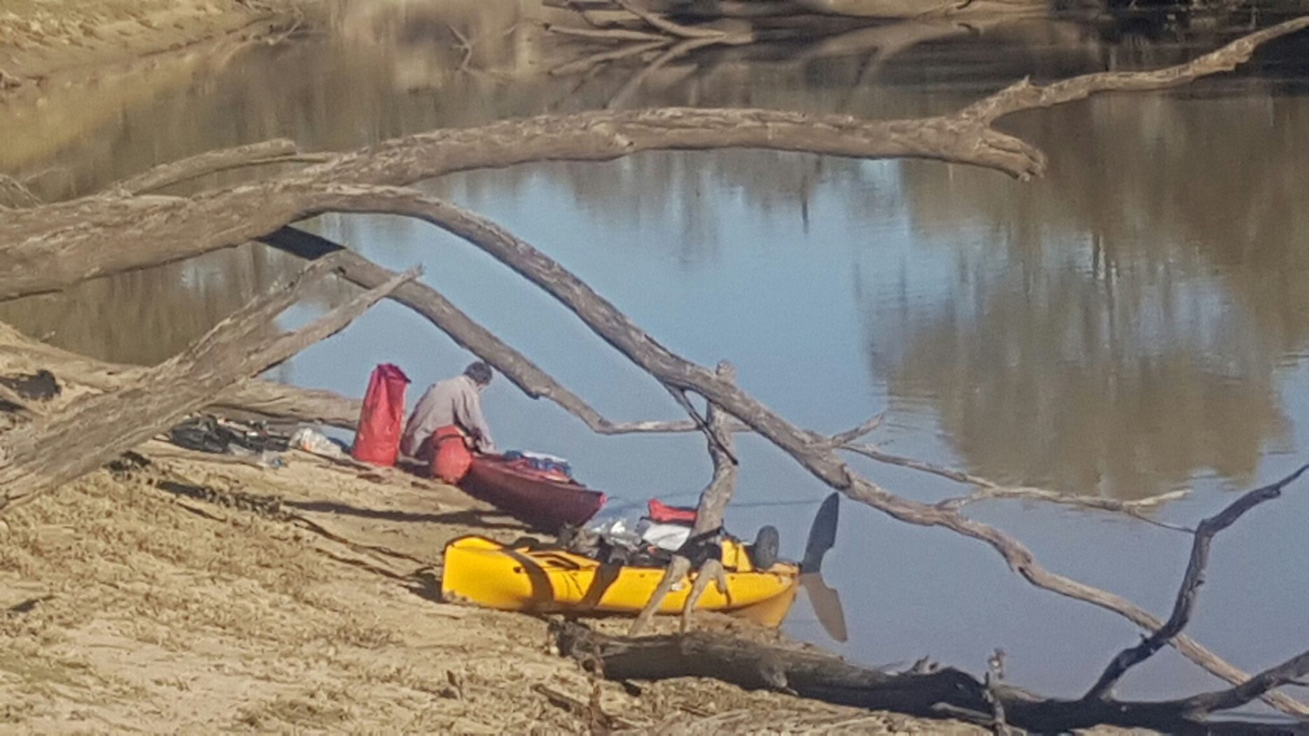
Launching at the Bourke Wharf is difficult, but easier than landing ’cause we had gravity on our side. D., whose Hobie kayak is designed for a set of wheels to slot into the hull, inspected the bank above and below the wharf and declared that there was a far easier launching spot about 800 metres downstream. B. and W. who were sharing a trolley took what seemed the easy way out and slid their boats down the grassy bank at the wharf. The only problem encountered was that a couple of local lads on the back of a trail bike took an interest in the gear. We had been warned by the locals never to leave our gear unattended and it seemed like good advice.
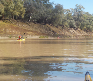
By the time the boats were loaded and launched an hour had passed. D. was already on the water and all three adventurers arrived above the Bourke weir at about the same time. The Bourke Weir is a modern formed concrete construction and it was easy to portage on the east bank. Once we were past it was 200kms to Louth. Below the weir the river widened and it seemed that there was almost zero flow though there was plenty of water flowing over the weir. As we rounded the first bend and the weir was out of sight the countryside quickly became wilder and we river and its surrounds became progressively more beautiful with every kilometre paddled.
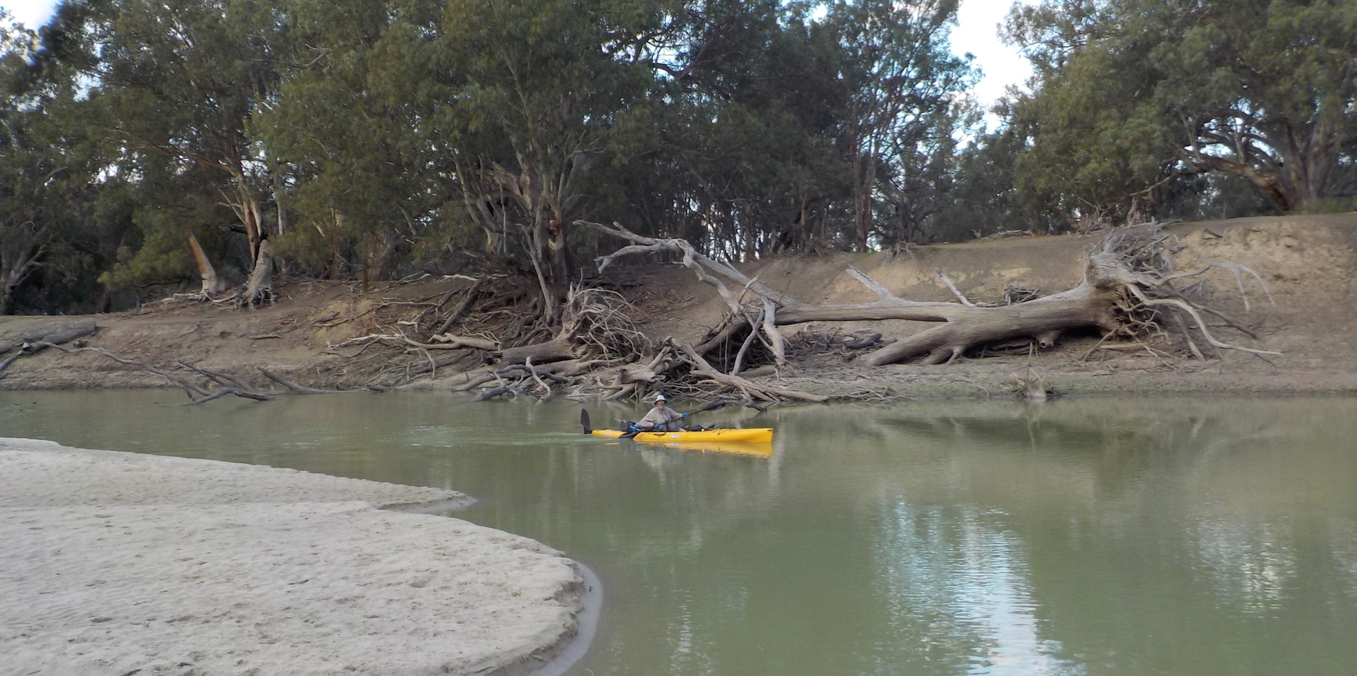
The banks were lower than through most sections of the river so we were able to see the surrounding countryside. Again the most common animals we saw were feral goats but every bend held a flock of ducks while every reach had a resident darter. We started looking for a campsite early that afternoon and found a sandy beach 26km downstream of Bourke. We fished into the night and caught nothing but carp, though B. lost a big cod in a snag after a long fight. The carp were unusually pale, a light brown/golden colour and their skin and eyes were almost transparent.

Day #11 – 26kms – 55km Downstream of Bourke
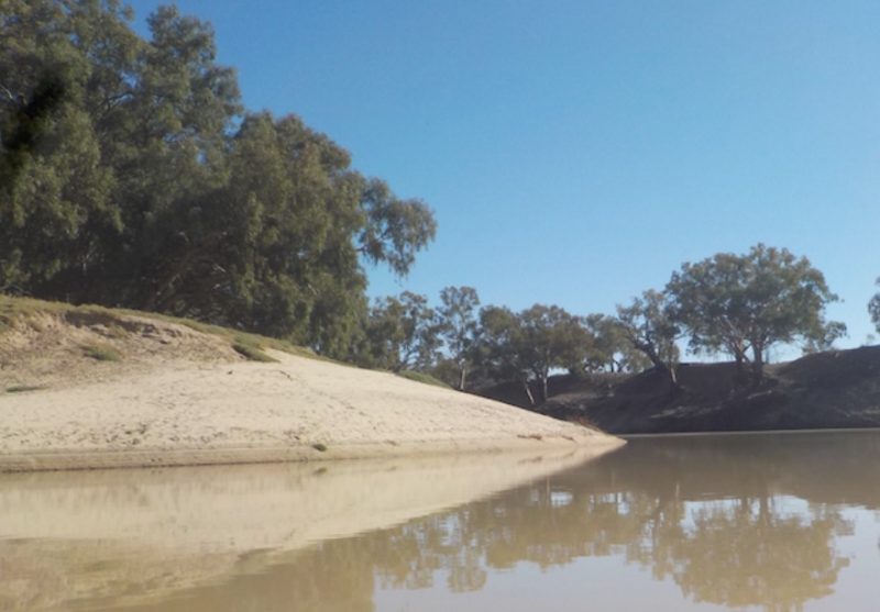
Through this section the river is wide and there was no discernible flow. But there were plenty of great looking campsites. White sand beaches were common on many of the bends. There was more and more animal life the further we traveled downstream. Again we saw many large flocks of ducks which were flighty and generally took to the air before we were within 100 metres of them. Sea eagles were common through this section. The river meandered a lot and rocky reefs and banks were common.
The second weir below Bourke town is at the 54km downstream mark. The drop was about a metre and a half. We portaged on the eastern bank, relaunching about 200 metres downstream. It’s trickier to cross than the Bourke weir upstream. A couple of kilometres below the weir there’s a short cut shown on the maps which was navigable when we passed and we took advantage of it like we did for all the short cuts the whole length of the river. In most cases these cut-throughs are the true course of the river with the longer meander being bypassed relatively recently. Some purists might prefer the longer route, however in almost every case the shorter option was the one with the highest rate of flow and the direction in which most of the current headed.
Other than regularly seeing flocks of parrots including a small group of Major Mitchell cockatoos the river conditions and its surrounds were much like the section we’d travelled the day before. Rocky reefs on the banks were common and in the morning at least when a strong, cold wind was blowing we saw a lot of goats sheltering below the banks. Again, they paid us little attention.
In the first 15km below the Bourke weir we passed great looking camping sites on every bend of the river. Most had white sand beaches and as for the whole length of the river there was enough firewood for a hundred campfires. We camped at the first good spot we saw below the second weir under the red gums. That evening as the sun felt it was almost for a while like being on safari as groups of goats, kangaroos and pigs came down the opposite bank to drink. Right on sunset there was an explosion of activity in the river. Fish were rising, jumping and hunting along the whole reach. We set our fishing lines but again caught nothing but carp and a few shrimps in the pot, none of which when used as bait produced a decent fish.


Day #11: 55km – 91km Downstream of Bourke
It was cold overnight, -3 deg C according to the report we heard on the radio and was confirmed by D. who showed us a sheet of ice about 1.5cm thick which had appeared in the back of his kayak. There was nothing new in this section of the river to report other than all of us getting very close to pigs while paddling. The further we travelled the more swine we spotted while through this section we also saw egrets, herons and large flocks of smaller black cormorants.
We passed white sand beaches all day while paddling and crossed one genuine rocky rapid which would not have made grade 1 but provided a minor thrill after days of paddling flat water. We finished 91kms downstream of Bourke camping on the banks of the river on Toorale National Park. It was a comfortable spot on a long straight reach of the river with high banks. Again at twilight there was a procession of goats, ‘roos and swine coming to the opposite bank to drink. The spot was comfortable and looked fishy so we decided to stay the next day, settling in with a stack of fallen red gum boughs, the bait pots set and all six of our fishing rods in the water. Despite fishing all night and all the next day we caught nothing but carp and a few small “spangled perch” in the pots.
It was another cold night and the next day we enjoyed our first rest day on the river. W and B. went for a walk along the banks through the Toorale National Parka and returned to report that everything they’d seen there was evidence of pigs tearing up the soil and undergrowth. This confirmed what a lot of locals had told us, that the government controlled lands were overrun with feral animals many of which emerged from the protected territory to raid surrounding farmland under cover of darkness. One interesting thing was that for the first time on the trip we heard a lot of insects at dusk and overnight. Toorale national park had some wildlife.


Day#12: 91km – 130km Downstream of Bourke
Plenty of birdlife through this section. Large flocks of cormorants and pelicans along with heron and egrets on most reaches. We also saw another small flock of major mitchell cockatoos. The river was high banked and wide most of the way with barely any flow. Most bends had sandy beaches. There were three shallow reaches of the river with sand banks above the water but in every case there was a clear channel to follow. Another interesting sight was four large groups of whistling kites riding thermals high in the air. It was like a classic scene from an African safari movie with the vultures circling above.
Day #13: 130km – 168km Downstream of Bourke
Three corners past our campsite we saw the best camping spot we’d seen so far the whole length of the river and in retrospect probably the best on the whole Darling. A huge sandy beach marked the entrance to a short anabranch of the river which rejoined the main stream about 200 metres downstream, forming an island. We all wanted to stop and hang at the ‘Isle of Kings’ for the rest of the day but one of our party had to finish the trip at Louth and we were running short of time. Truly a beautiful spot which we agreed to return to one day.
With every turn the river became more beautiful. One interesting sight was two whistling kites dive bombing a cormorant. The cormorant had a full craw, and it looked like the kites were trying to get it to disgorge some of its catch.
We passed the mouth of the Warrego river which had a thin line of water which reached about 150m upstream before the Warrego was blocked with snags.Around a couple more bends we were surprised to see a boat load of fishermen. The first people we’d seen on the river since a long way above Bourke. They weren’t catching ay fish except carp and were planning to be at the Louth pub in a couple of days.
The upper Louth weir was crossed at lunchtime. It is a fairly primitive weir made of broken rock and rubble. It was easy to walk the boats over the rocks on the left hand side though there was a channel through the middle of the weir which could perhaps be paddled in slightly higher water. B. made an attempt on the current but became unstuck when the Seabird kayak tracked straight into the rocks and went broadside in the current.
Sitting in the sun on the banks of the river, downstream of the weir a local landholder appeared, riding an old ag bike with three kelpies sitting on the rack. Like everyone we met along the way he was keen for a chat. He was out mustering sheep and checking his goat traps. We’d seen a few temporary yards along the banks and had wondered if they were for trapping pigs. It was explained to us that the goats are extremely smart and wit was difficult to lure them though a gate into a trap. Instead they put a step outside the enclosure which the goats would use to jump over the fence. But there was no step inside so once they were in they couldn’t jump back out. This strategy worked well for the females and kids but the billies were more wary and once a few goats were trapped they were less likely to fall for the ruse. not for the first time we were told that goats were supporting the local economy at least as much as sheep. The dressed price for goat was $6.70 a kg which made a trailer load of the ferals worth upwards of $100k.
A couple of kms downstream of the weir was a small fishing camp, a collection of caravans and shacks. We found a great campsite and finished late that day, setting camp as the sun fell.


Day #13: 168km -Louth. 205km downstream of Bourke
We crossed a series of small rapids and runs soon after we started paddling. There were many large sandy banks and beaches, some of the best we’d seen for the trip. Plenty of pigs in this section, many sleeping on the sand under the banks, away from the cold wind blowing from the east. We could get close enough to some of them to slap them with a paddle.