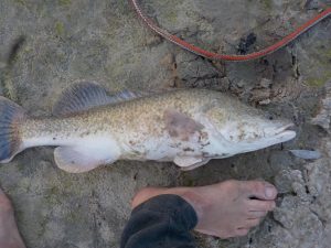
This section was the longest, most interesting and most remote of the trip with the best fishing. The wildlife was outstanding – the largest number of native species sighted and traveling across the lakes was the most memorable section of the whole river.
Day #32: Warrawong Station (2km upstream of Wilcannia) to 26km Downstream of Wilcannia
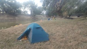
Everybody will tell you to avoid staying in Wilcannia and stay at Warrawong a couple of kms upstream. It was good advice.
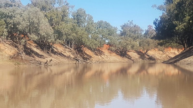
The Wilcannia weir is just upstream of the bridge. You can access it by car driving into the council caravan park. The weir is relatively easy to cross. There’s a gap in the rocks on the right hand side you can walk a boat through. Downstream of the weir there is a reed bed and a few different channels which come together a couple of hundred metres downstream. After that there are reed beds in the river for about 5km.
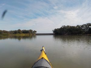
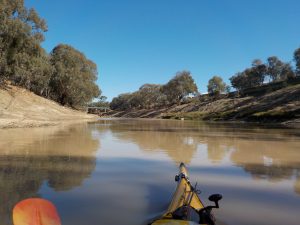
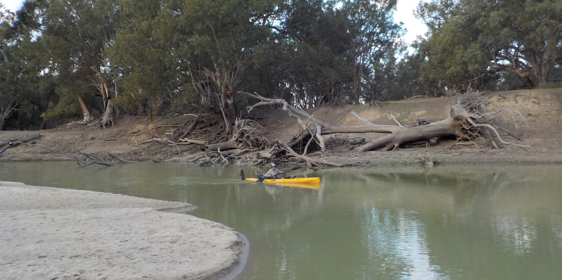
Campsites and river conditions were excellent through the whole day. Overall it was probably the most scenic section of the river to date and almost every major bend of the river held a sandy beach. And as the water began to back up from the Menindee lakes below the water was the clearest we’d seen. In some cases we could see about 150mm! Above the Wilcannia weir the visibility, if you could call it that, was about 5mm.
Day #33: 26km – 62km Downstream of Wilcannia
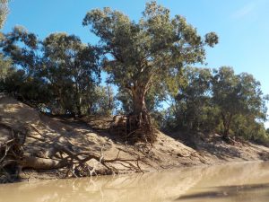
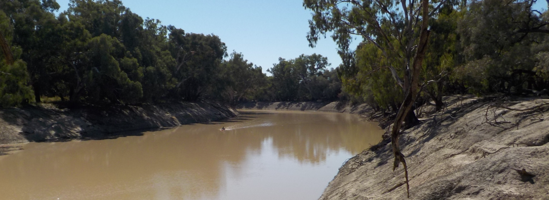
The river meanders a lot through this section and it’s beautiful paddling. Most of the way the banks are as steep and high as you come to expect from the Darling but there were many gaps so that on many reaches of the river there were easily accessed places where the surrounding countryside came down to the level of the river.
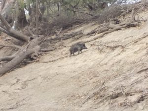
For anyone interested in pig shooting, this section of the river s a good place to consider. We saw pigs in the middle of the day on just about every reach. If the wind was right it was easy to get as close as ten metres before they decided to take off. More than once a pack of swine charged into the water in panic when they realised we were approaching. Once a cohort of four despoilers followed their leaders into the water but half way to the other side three decided to turn back and climb the bank they started on.
We’d seen the occasional decapitated pelican upstream and here below Wilcannia this became a common sight. On one bend we saw four decapitated carcasses with drifts of feathers scattered about. D. performed a quick autopsy on one of the victims. It was the characteristic dog-pad footprint in the sand which revealed the identity of the culprit, ol’ reynard. We’d seen many foxes on the banks while paddling. Most mornings they did their rounds along the high water mark and so it seemed that at night they attached the outliers of the pelican flocks while they slept.
We saw large flocks of black cockatoos several times through this section. They were always raucous and curious, often watching us closely from a tree on the opposite bank and sometimes sending a spy closer to have a better look. When their agent returned to the flock there was would be a lot of chatter as they exchanged views. Anybody who believes these birds do not have a complex language is not paying attention. One morning, I can’t remember exactly where on the river as the sun rose a couple of black cockatoos were sitting on a low branch right next to the tent. They are more cautious than most of the native parrots and would not sit on a low branch if we were nearby. In this case were were both in our tents and it was only because I had a quick look out before that I saw the two black cockies pacing back and forwards on the branch and waited for a moment to see what they were up to so they weren’t spooked immediately. They were looking at the camp very carefully. Like most animals with their eyes widely set on opposite sides of their heads they had to turn one eye towards the object of their curiosity. I saw them looking very carefully and then comparing notes in a low crackling voice. After watch them for five minutes they flew to a small exposed snag in the middle of the river where they took turns to drink. One watched out while the other drank his fill. The drinker put its whole head under water. Beautiful and intelligent animals. We saw no correlation between the often repeated advice that when you se the black cockatoos it’s about to rain.
Day #34: 62km – 99km Downstream of Wilcannia
The river runs slowly through this section with predominately long deep reaches. Hardly a goat to be seen but again plenty of pigs. As we set up camp that night pigs came down to drink on the bank opposite and seemed to have no interest in us at all.
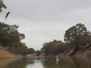
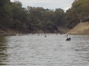
The main wildlife feature on this day which started to make their presence felt was the huge flocks of cormorants and pelicans attacking the schools of bony bream. The cormorants and pelicans seemed to work together. Hundreds of the small, all-black birds dived under the water in waves, competition amongst individual members of the flock saw a constant changing of the front ranks of the avian assault as they scrambled forward to get first go at the newly discovered school of baitfish below. While the cormorants went underwater the pelicans remained on the surface, looking for individual fish flushed upwards from deeper water. Judging by the number of times the pelicans’ heads shot forward which they followed with filtering water from their beaks to trap the fish which was swallowed when they threw back their heads, the fishing was good.
The air above the river was also full of birds, most of the same species. On one occasion two large flying flocks crossed, one heading south the other west. Suddenly some of the leaders of the flock heading west peeled off and joined the other flock heading south. That eventually caused every bird in the west heading flock to join those heading south.
Day #35: 99km – 136km Downstream of Wilcannia
Forgot to take notes on this section but could safely say it was similar to what we saw on day #36.
Day #36: 136km – 169km Downstream of Wilcannia
By this stage there was barely any current on the river and the backup from the lakes made it feel like we were paddling still water. As the river settles and flows more slowly it becomes wider and the water clearer. Besides the ever increasing flocks of pelicans and cormorants there were also huge flocks of black ducks.
Around one corner we did witness an archetypal act of evil. A tiny recently born lamb, bleating pitifully and unstable on its feet was set upon by a wedgetail eagle. The eagle jumped from a low bare branch and drove its talons into the miserable lamb. I’d grown up in an era when wedgetails were considered to be vermin and had heard many people accuse them of being lamb killers. These days wedgetails seem more interested in scavenging roadkill. This wedgetail was the Johnathon Livingston Wedgetail of the raptor clan.
Campsites were hard to find through the section as the restricted current seemed to limit the formation of beaches. The only beaches to be found were on major bends. After loking for almost 5km we finally found a high grassy bank. When we walked to the top of the bank we chased off a mob of kangaroos which had had the same idea that we had.
Day #37 : 169km – Nelia Gaari Station 199km Downstream of Wilcannia
The water became more still, deeper and clearer through this section. By the time we arrived at Nelia Gaari Station you could see almost a metre into the water and everywhere bright green non-toxic algae was growing in the water which would have been the basis for the highly active food chain.
Day #38 : Nelia Gaari Station
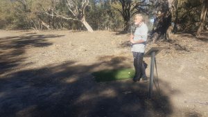
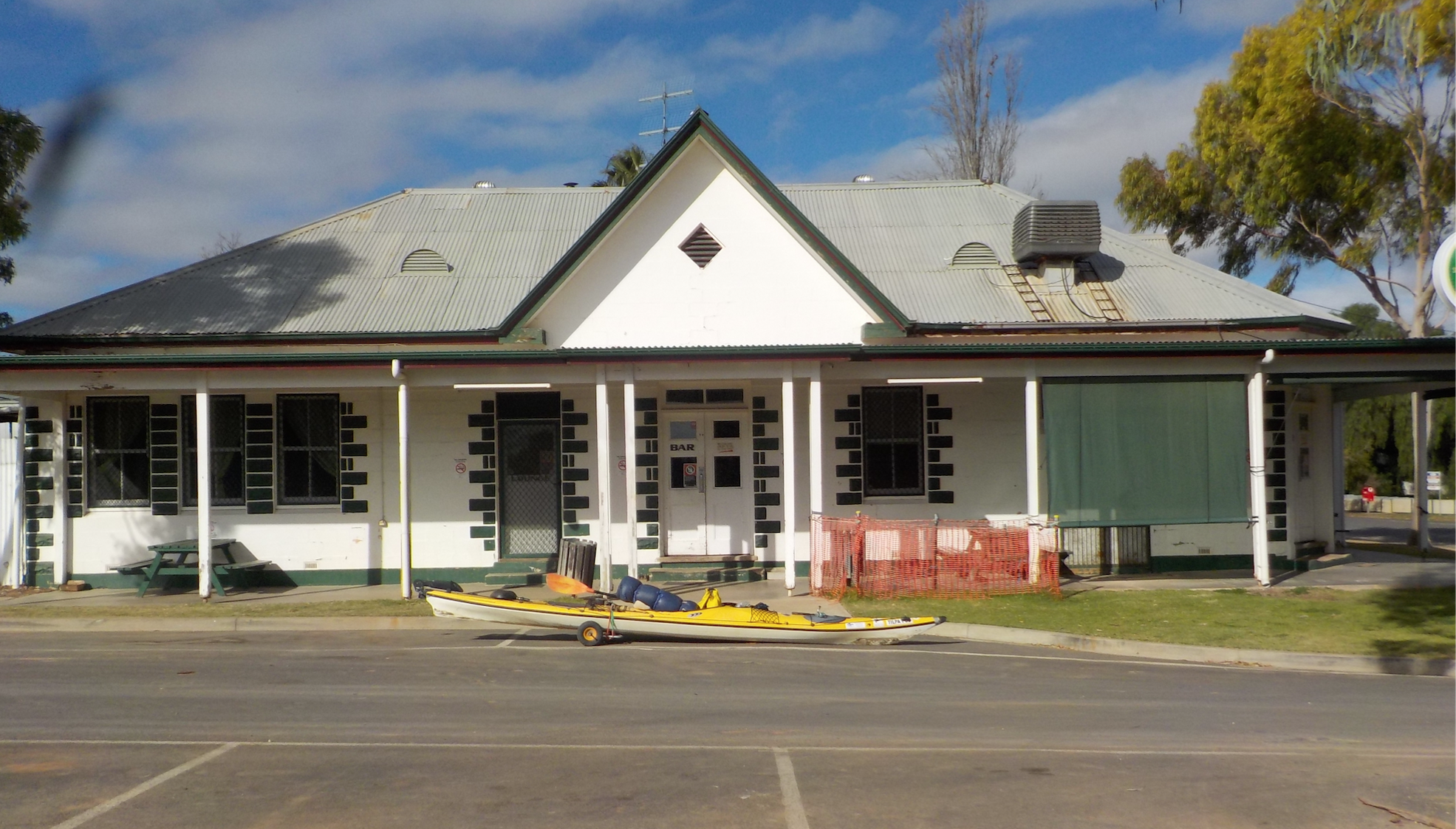
Nelia Gaari was the best set-up station we saw on the river for travellers. We were made to feel right at home amongst the 6000 head of merinos. The sites set aside for caravans and camping were on a superb reach of the river under mature redgums. And of course there was the golf course for which W. now (dubiously) claims the course record of 42 shots.
Day #39 : 199km – 241km Downstream of Wilcannia
As the sun rose the fishing birds started attacking the schools of boney bream. It was like a feeding frenzy at sea as hundreds of pelicans and cormorants thrashed the water to foam, diving and competing for clear water and first shot at the swarming boney bream. As the flocks of cormorants flew overhead we could feel the change in air pressure and the sound of their wings beating was like distant jets.
It was flat water paddling all day with the river now an extension of the lakes and the southerly headwind we paddled into all day didn’t help. The water was clear. There was a subtle, unmarked cut through short-cut at the 225km mark which wasn’t shown on the map. Campsites were hard to find through this section with high water and little flow so very few sand beaches had formed on the banks.
Day #40 : 241km – 275km Downstream of Wilcannia
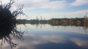
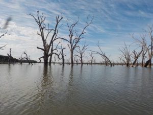
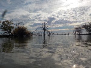
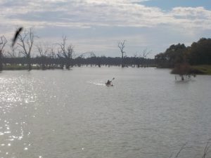
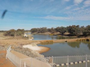
The maps you’ll see of the Menindee lakes probably assume that the lakes are full. There are no such things naturally as the “Menindee Lakes”, rather they are the flood plains of the Darling transformed into lakes by the weirs and regulators. There was not enough water in the lakes to be able to cut through the fringing trees and take a direct line to the regulator. It was difficult to understand exactly where we were on the maps but by following the fringing lines of trees which marked the original course of the river we had no problems navigating through this section into more open water where we could take advantage of some of the cut-throughs between meanders.
Roughly, the course of the river follows the southern boundary of Lake Wetherell. After speaking with Craig at NSW Water who gave us some clues on how to make our way through the maze on the lakes. Apparently Wetherell technically begins 50kms downstream of Wilcannia. That confirmed our experience paddling through still water for the last week.
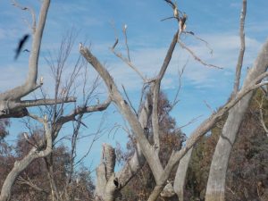
The banks were largely semi-submerged trees with nowhere that looked like a comfortable spot to camp. Checking the GPS later it appeared we paddled an extra 8-9km than the distances shown on the maps. Looking into the clear water in the shallows the lakes were full of life. There were clouds of daphnia (water fleas) in the water which were the food sustaining the large schools of boney bream which the cormorants and pelicans were monstering.
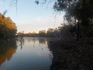
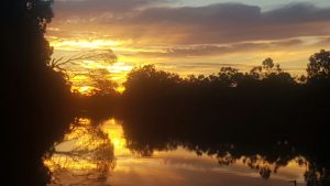
We had to camp on an uncomfortable slightly raised piece of ground, the only half decent campsite we could find. The worst campsite we’d had the whole length of the river but the most beautiful sunset. Over ten minutes the clouds and sky changed from a vivid metallic gold to a deep purple. All the time the huge flocks of birds cut across the sky now looking for a place to roost.
Day #41 : 275km Downstream of Wilcannia – Menindee Township
A great section of the trip, we finished crossing the lakes, portaged the weir regulating water to the lower Darling and paddled the final stretch below the lakes into Menindee township. An interesting sight was a flock of silver gulls (seagulls) here in the middle of nowhere. They were slimmer and less rowdy than their oceanic brethren.
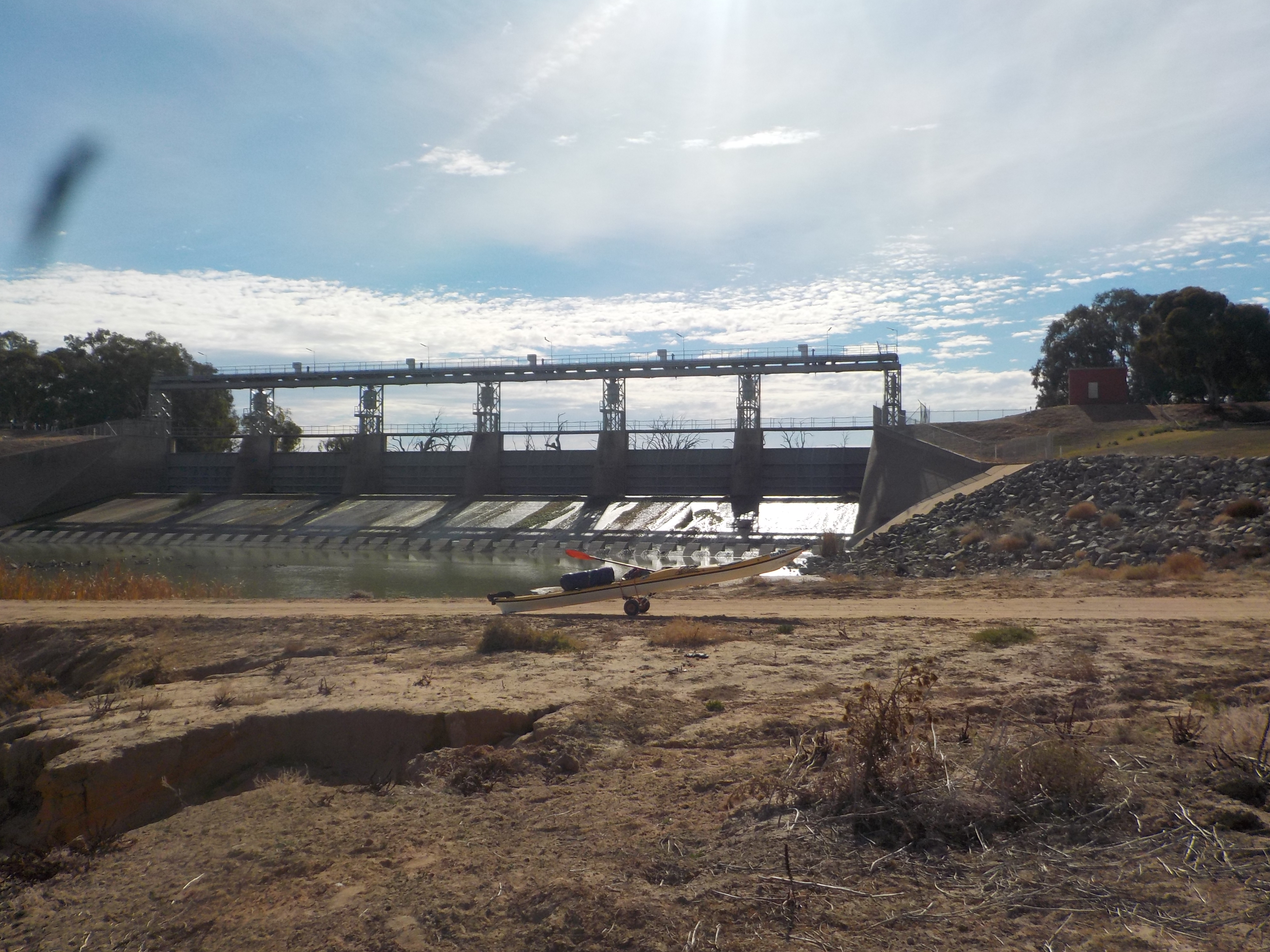
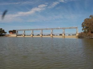
Following the old course of the river the first major man-made feature you’ll spot is the Pamamaroo regulator which controls the flow of water from Wetherell into Lake Pamamaroo. Paddle past this and keep heading to the left to find the main regulator and the beginning of the lower Darling.
There was barely a trickle of water going over the main regulator to the river. We dragged the boats out and portaged the regulator while the “River Lady” departed the same spot with a group of tourists on board. It was then another 28km of hard paddling downstream to arrive at Menindee township. It’s easy to get off the river at the Menindee boat ramp, less than a hundred metres upstream of the bridge on the right hand side.


2 Comments
Add Yours →Fabulous record of your trip, thank you for sharing
A group of us paddlers are planning to do Wilcannia to Menindee last week I’m May.
Could I be so rude and ask where you got your maps that you would have carried on board? I love putting maps together for river trips.
If you had the time and you would like to call to add some advice/enlightenment that would be too good.
Kindest regards,
Liz Winn
0407 959 047
Lizwinn55@hotmail.com
Hello
I’m hoping I can get some positive advice from people on this page regards travelling by boat (small tinnies with outboard motors) down the Darling River from near Burke to the confluence at Wentworth.
My mate and I have travelled down the Murray from Cobram to Gawler and now would like to travel by tinnies down the Darling.
I have spoken to personnel at the Burke & Brewarrina visitor information centres but have not been able to get relevant information on travelling by boat along the Darling. .
My main query is what if anything is available to help people in motor boats get around weirs & levees.
We are planning on starting our trip early October for 4 – 6 weeks
Thanks for taking the time to read my post.
Cheers Keith