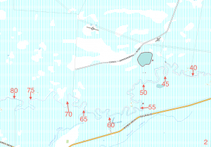
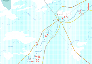
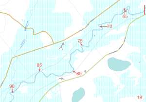
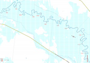
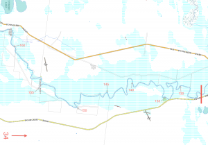
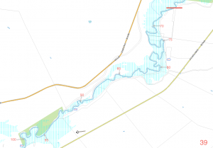
We had a full set of official topographical maps, which cost around $250 but most of the detail on them was irrelevant and therefore unnecessarily confusing. What we found more useful were screenshots of the excellent NSW Lands Department maps. Using their distance estimation tool we marked the maps with 5km increments. Copies of each of the 43 individual maps are shown on this blog, most probably in an outrageous breach of copyright (if they’re no longer on the site it’s because we received an email to cease and desist!). The maps were ideal for the trip though the distance estimates shown on them are out by about 5% (higher) as far as our cross checking with other published distances could confirm. It was easy to follow the river bend by bend and almost always have an accurate fix on your position, which becomes important to you on a long trip.
An interesting aside on the estimation of distances…. every local you speak with will tell you the actual distance between towns following the meanders of the river is 3 x the distance by road. When you look at the maps it’s easy to understand how you could make this assumption. But the reality it is it almost exactly double and if you double the distances shown online between towns you’ll be very close to the actual distances by river. The locals we spoke with along the way were very dubious about this advice, however the facts are pretty clear.
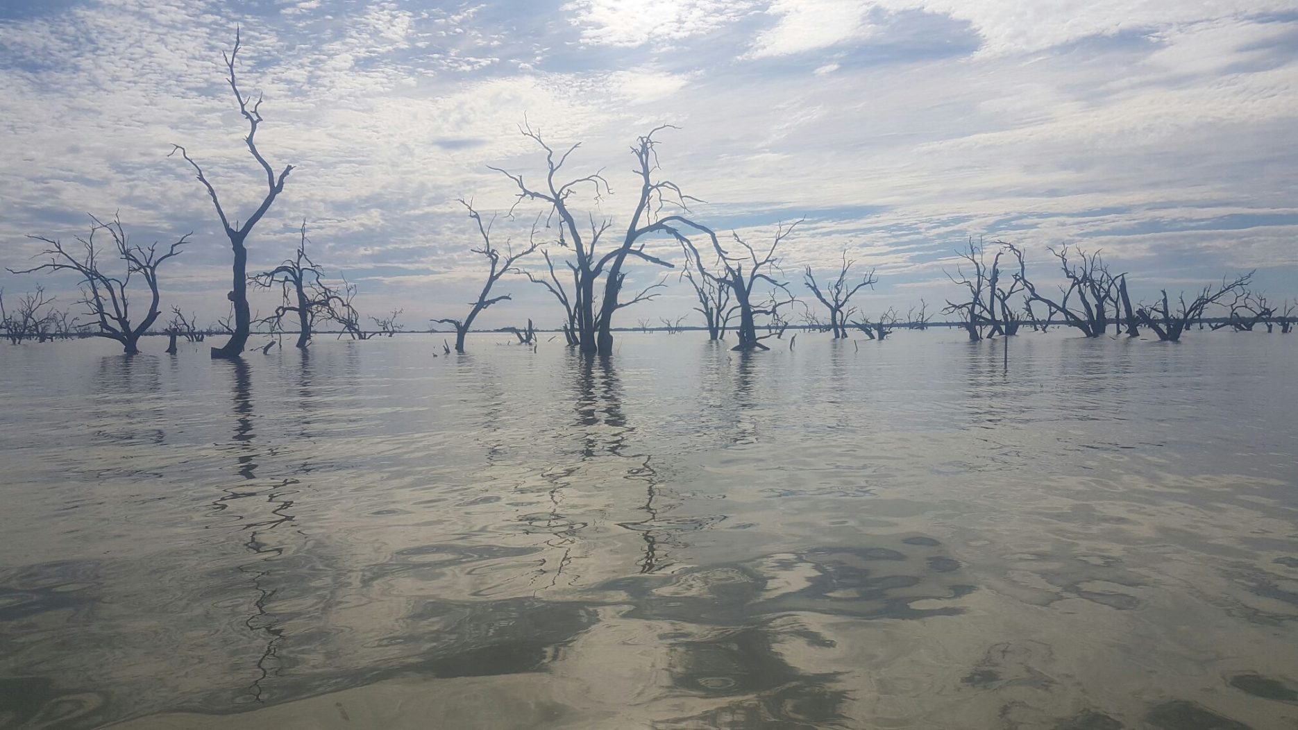
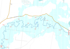
The only section of the river where the maps were of limited use was the Menindee Lakes. The maps show the lakes filling their entire floodplain while the reality is unlikely to reflect this unless you’re out there after a major flood event. You can’t make a bee-line to the regulator which marks the beginning of the lower Darling without having to navigate through a forest. It could be possible to find a channel but the chances of getting lost and/or reaching a dead-end then having to backtrack would outweigh any time and distance savings, given our navigation skills, at least. As a result the distances shown through the lakes are wrong. The course you’ll have to take meanders as much as the Darling does the rest of the way, so you can safely double the estimated distances shown. However, the maps are an accurate guide to the location of the outflow into the lower Darling with Menindee township then about another 25kms downstream. To find it you’ll have to improvise a little and follow the old course of the river which is clearly marked by the remains of fringing red gums. Stay between the two lines of dead flanking trees and you’ll get to where you need to be even though at times it may seem you’re lost on an inland sea. Of course you can use Google maps or a GPS. There was Telstra mobile coverage almost the whole length of the river (unfortunately!). We preferred to all be working to the same plan and using printed copies of the maps shown on this blog we were always literally on the same page, plus printed out at A4 size they could easily be read while paddling. If you use the maps note some are in landscape and others portrait format. The orientation of the page number (which appears in bottom RH corner) will show you which way the maps should be read.
A few points to note on the maps if you got bored reading above:
*Maps are in a mix of landscape and portrait format. To orientate the map the right way look to the page number in the bottom, right hand corner which will read the right way when the map is being held in the correct orientation
*The maps should be read from right to left because we traveled downstream
*The red rectangle/line you see intersecting the river on the right hand side of each map marks where the previous map finishes. You’ll find this helpful in avoiding confusion where the maps overlap when switching between pages
*Distances shown on the maps are exaggerated by about 10%, in addition two or three 5km marks coming into the Menindee lakes understate the distances by 1-2kms. Officially the length of the Darling is 1,472kms, plus the 90km from Brewarrina to the mouth of the Culgoa makes a total trip distance of around 1,560kms. Our maps calculated the distance as 1,710 km. For us it was not a big deal as the distance marks were used useful mainly in planning daily objectives.


3 Comments
Add Yours →Wow. Just what I am looking for to navigate down the darling in my 28 foot solar powered falucca In April. Am I able to print out?
Cheers
Tuesday Browell
We are thinking about taking a dingy from Perth WA over to do the Darling River in 2023 as we have already completed the whole of the Murray.
This resource is excellent thankyou!
Hi, I am planning on boating down the Darling from Brewarrina to Wentworth in October 2023 with a mate. We will be in 2 aluminium boats fitted with outboard motors. We will also have a support crew following in 4WD. The maps of the river that you have provided are terrific. Just wondering if you are to provide further information in respect to camp sites and issues/location of hazards such as weirs.