Finally, After Years of Talk and Planning
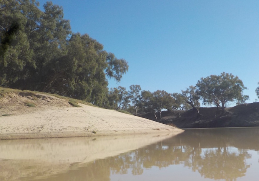
Long ago, in what seems a different world, driving from Melbourne to a beach somewhere in northern Australia on what was once the traditional summertime Australian holiday I can recall waking for a moment and staring from the window of the family car to see below as we crossed a rickety, wooden bridge a dark brown, winding river with verdant banks which seemed entirely out of place in the flat semi-arid, red-hued, mottled grey-green specked landscape which stretched to the limit of sight in every direction. While it lasted only seconds, this momentary glimpse of the fabled Darling River left so strong an impression that for many years upon hearing mention of its name I was immediately transported back to once again experience those same feelings of remoteness, silence and wonder at the unexpected fertile band of countryside in an otherwise inhospitable landscape. Far from fading from my memory, as the years passed the singular impression the great river made became ever stronger and the urge to travel that long, silent and lonely waterway grew year after year.

In the early 1980’s we talked about returning to that slow-flowing outback stream. Instead we ventured down rivers in Victoria closer to home – the Goulburn, McAlister and Snowy. Rivers like most in Australia which require as much dragging and portage as paddling. Always, in the background was the silent but profound call of the great outback waterway. In 2015 when planning started again we were no longer fresh-faced youths, our own kids were the age we’d been when the plan had first been hatched. But now some of the responsibilities carried for over 30 years were checked-off and it seemed we could spare the 6-8 weeks required to answer the Darling’s insistent call. And if there’d been any water in the river water we would have made the trip.
In 2015 we made the first of the great navigations, the length of River Murray from its forested, mountainous source in the foothills of the Great Dividing Range to its exhaustion in the Southern Ocean. Over 2,400 kilometres and a great journey in its own right, a trip which has been completed hundreds of times by lone adventurers and groups. The Murray is as interesting and rewarding as traveling the length of the Darling, particularly for those of us who are of an age to have learned of Banjo Patterson and Henry Lawson at school and know something of the fascinating, richly textured history of rural Australia and the riverboat trade the rivers once supported.
In 2016 we made time again to travel the Darling but there was less water than 2015. Things were worse than usual as the Darling was reduced to an unappealing string of drab, khaki green, saline waterholes, its course interrupted by informal earthen weirs constructed in desperation so the last of its water could be exploited. Instead, we traveled the most serene and least navigated of the three great rivers – the Murrumbidgee. A scenic, seemingly remote and fertile river the Murrumbidgee flows from its arising above Canberra to its confluence with River Murray through some of the richest farming and grazing land in Australia, past towns whose fortunes rose and fell with the distant northern hemisphere’s demand for Australia’s beef, wool and wheat. However far from satisfying us, this journey (like the navigation of River Murray) made us more unsettled and ever more determined to paddle the length of River Darling.
Finally in late 2016 unseasonal late Winter and Spring rains through central Queensland and NSW saturated the catchment so despite the traditional late Summer rains in Queensland which sustain the Darling most years not falling, the tail end of cyclone Debbie reached into the Queensland catchment and delivered enough rain to ensure the great outback waterway flowed its whole length through the Summer and Autumn of 2016/17.

The Darling River officially begins at the confluence of the Culgoa and Barwon rivers, about 90kms upstream of Burke, however the headwaters of the rivers which converge to form the Darling are almost 2,900kms from the Murray river mouth at Goolwa. While officially the Darling (1435kms) is the third longest in Australia, after River Murray (2,400kms) and River Murrumbidgee (1465kms) studying a map of the extensive Darling catchment and a recent navigation by River Kings TrK.B and TrK.W of River Dumaresq which runs along the Queensland NSW border confirms River Darling actually begins at the western foot of the Great Dividing Range where the Severn River flows into and then emerges transformed below Pindari Dam. River Severn joins with River Mole to form River Dumaresq, which then winds its way west, becoming first River Macintyre then River Barwon before finally assuming the name Darling some 120 kilometres downstream of Brewarrina.
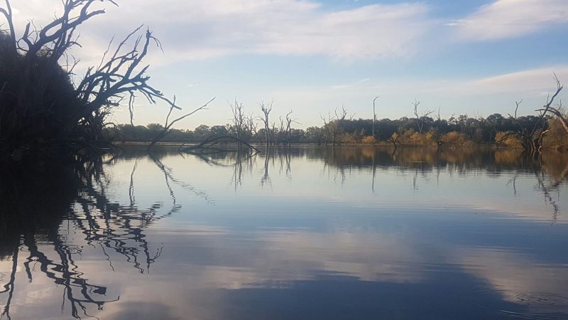
Navigations of the length of the Darling by rowboat, kayak, canoe or powerboat have been completed many times since settlement however finding reliable records of past groups who have attempted the trip by kayak was almost impossible. Several books have been published over the years but the few we read were pushing an economic or environmental agenda and provided little or no guidance for prospective travellers. These literary efforts also seriously understated the river’s beauty and atmosphere to promote a story of environmental degradation and despair. Like much of rural Australia the population along the Darling was far higher a hundred years ago when agricultural production required more labour and comprised a more significant proportion of the national economy. Little contemporary information on river conditions, accurate measures of distance and useful descriptions of the riparian environment has been shared online so we are publishing this blog and recording our thoughts for others planning to undertake Australia’s greatest outback adventure. It is by no means definitive, and is comprised largely of our own subjective impressions but we hope that any readers planning to complete the navigation will be encouraged to do so, for it is a wonderful adventure which even we seasoned river travellers enjoyed beyond all expectation.
River Levels

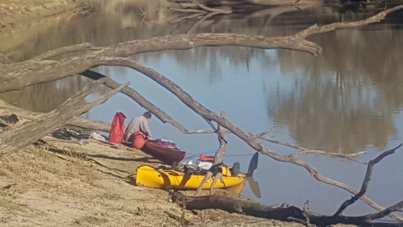
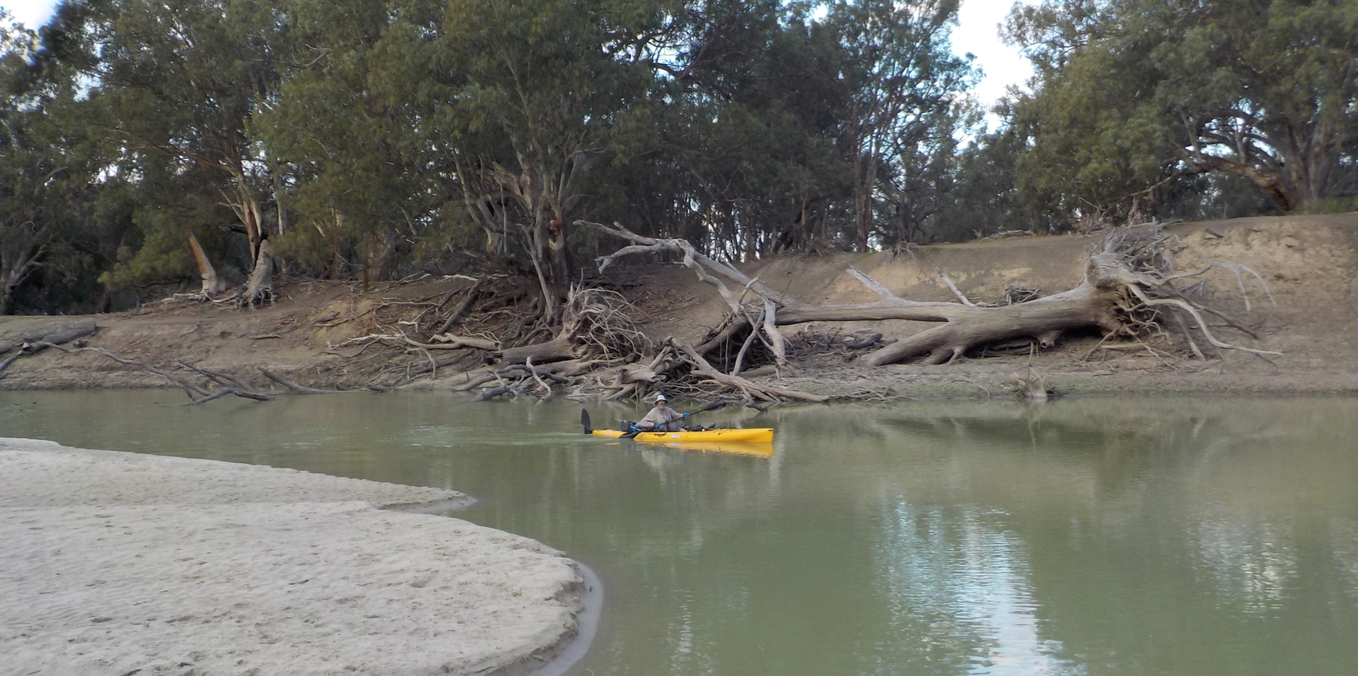
We were very lucky. The river flowed strongly for eight months before our departure and was completely flushed of salt and blue-green algae which had accumulated in the previous 18 months. When we started the flow at Brewarrina was about 380ML per day. This level of flow remained almost constant until the Menindee lakes though there were a couple of minor bursts of increased flow, one while we between Louth and Tilpa and the second after Wilcannia as rain which had fallen in the border river catchment in Northern NSW supplemented the water in the Balonne/Condamine branches from central Queensland. Downstream of the Menindee is a different ballgame and daily flow at the time of our trip was around 220ML, still plenty to avoid bottoming out or having to portage anything but a couple of major snags. Talking to the very helpful staff at NSW Water we had been assured in previous years if there was any flow at all, even a mere trickle of 10-20ML a day, the river would be navigable its full length because of the weirs. From what we saw there is no reason to disbelieve it, though obviously more snags would be encountered and most likely the top of the weir pools – on the immediate downstream side of every weir – would be more difficult to navigate and it would be likely at several of them there would be some portage and labour required to make it to navigable water.
2 Comments
Add Yours →Hi Riverkings,
For some years now, my friend and I have thought about paddling the Darling, however whenever we make enquiries, there is never seems to be enough water to paddle successfully.
Over the past 12 years, (since retirement) we have, however, paddled the Murray from Albury, the Murrumbidgee from Jugiong, the Hawkesbury, the Myall, the Hunter and part of the Macquarie River. Currently the Barwon/Darling River seems to have plenty of flow and we are toying with going from Brewarrina to Bourke.
As always, logistics, mapping, resupply and many other issues need to be sorted and it would be of real benefit to to us chat with you about your Darling experiences.
Thanks and regards,
Lindsay Black
Hi, I thoroughly enjoyed reading all this. In your experience are the rivers you have paddled deep enough in most parts for navigation by a Native pedal kayak? I imagine there would be sections, particularly for some of the drier regions where the water level would be too shallow.
Also, do you have similar write ups for the Murray/Murrumbidgee rivers?
Cheers
Chris